Food Over the Chuseok Holiday
Dinner before Chuseok and Chuseok day brunch.
Reliable, confidential, fast, and accurate | 20+ years of experience
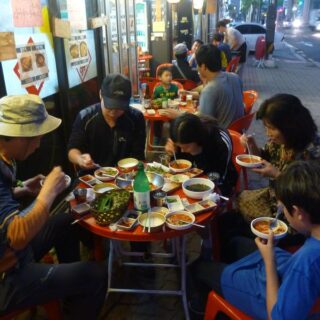
Dinner before Chuseok and Chuseok day brunch.
Views of Euijeongbu and surroundings from Sapae Peak in the Bukhansan National Park north of Seoul. From the top, you'd never know that a highway has been tunneled through almost directly below. (Visit in Google Maps.)
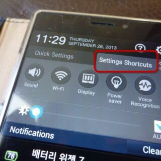
I few weeks ago, I came across a Korean translation error on my new Google Android smartphone. At first, I thought it was a mistake in the Android interface itself, but in the end, I decided it probably came from the Chinese camera supplier and just got plugged in to...
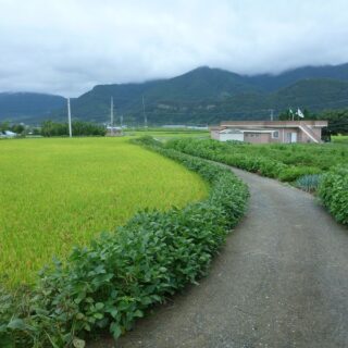
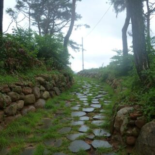
The rice fields at this time of year, and after heavy rains, were particularly beautiful.
North of Gurye, the path follows Seoshi creek. (Visit in Google Maps.)
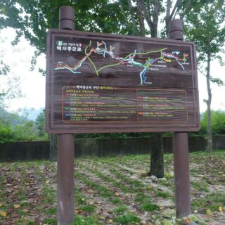
I was thoroughly confused about the path markers on this segment for quite a while before I realized that the Chirisan Doollae-Gil at this section overlaps portions of the Baekeuijonggun-Gil, which is a multi-section walking path from Suncheon city to north of Gurye. The signs for the two paths are...
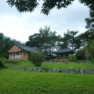
This gathering place of local residents for resistance to the Japanese during the colonial occupation was restored about ten years ago and is still well-maintained. Yongho pavillion (용호정) is the site of periodic commemorative ceremonies. (Visit in Google Maps.)

** Visit the related discussion on Korea Business Central: “How Can I Market My Business Online to Korean Consumers?” — The Internet has opened up possibilities for new business models, and many new online businesses are sprouting up in the field of teaching English as a second language. It’s not hard...

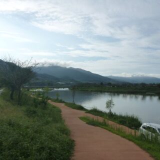
Having started at Omi Village, the path headed straight down to the river and then along the east bank north. (Visit in Google Maps.)